Breaking down is never a good experience, no matter the circumstances or where you are, but sometimes it can be a whole lot more inconvenient, or even dangerous, than others. For instance, breaking down on a road where other cars are whizzing by, the rain is hammering down or you’re stuck with no phone signal in the middle of nowhere is going to be worse than a breakdown close to the local garage.
Which got us thinking, where is the worst road, in the whole of Great Britain, to breakdown?
With the help of data science and a whole lot of data, we’ve been able to find exactly that out. We looked at more than 6 million co-ordinates of different road locations, and ranked them against factors that would make breaking down a particularly bad day; such as the amount of rainfall, traffic, distance from a petrol station or taxi company, phone signal and more. And we’re now able to officially crown the absolute worst places to breakdown. So, if your car is on its last legs, you should maybe avoid these roads… or simply scrap it!
The Top 10 Worst Places to Breakdown in Great Britain:
Taking the unfortunate top spot is the B725, near the Hamlet of Middlebie in Dumfries Scotland, due to its inconvenient mixture of poor weather and remote location. The road itself situated more than 20 miles from the nearest taxi company, almost 10 miles from a petrol station and 34 miles from a phone antenna, while being subject to low temperatures and 105cm3 of rainfall. All in all, making it a dream location for a horror film, but definitely not a stretch of road you’ll want to breakdown on!
- B725, near the hamlet of Middlebie in Dumfries Scotland.
- A489/A483, around three kilometres from the Welsh village of Caersws.
- A702, around three kilometres from the Scottish village of Elvanfoot.
- B6364, close to the village of Stichill in the Scottish Borders.
- A6, around the village of Shap in Cumbria.
- B6400, close to a hamlet in the Scottish Borders.
- M74, and the A74(M), again in the surrounding areas of Elvanfoot in South Lanarkshire.
- B740, a few kilometres out of the Crawfordjohn civil parish.
- A596, heading out of Netherton in Cumbria.
- A698, a couple of kilometres south of Bonjedwad in the Scottish Borders.
You’ll quickly notice a trend in the top 10, in that aside from the A489 in Wales ranking as the second worst place to breakdown in Britain, the list is dominated with Scottish countryside drives and A-roads in Cumbria – both found to be troublesome due to their remote locations and poor weather.
That’s not to say though, that the rest of Britain came up shining within our study. There was at least one road that stood out per region, as a drive that makes checking you’ve got enough fuel and your car is in good health that bit more important.
The Worst Roads to Breakdown on Per Region:
To find the worst roads to breakdown on in your area, take a look at our interactive map, or the list below, that even includes latitude and longitude points, if you really want to know the exact worst point on these stretches of road.
The Worst Roads to Breakdown on in Scotland
- Aberdeenshire: The A944 close to the Tillyfourie Quarry (Lat 57.2 Lon -2.6)
- Angus: The A90, midway between the small hamlets of Careston and Finavon (Lat 56.71 Lon -2.8)
- Argyll & Bute: The A816, also known as Soroba Rd, three kilometres south of Oban (Lat 56.39 Lon -5.47)
- Ayrshire: The A70, a few kilometres east of Holmston (Lat 55.45 Lon -4.57)
- Dumfries & Galloway: The B725, near the hamlet of Middlebie in Dumfries Scotland. This was even classed the most inconvenient place to breakdown in all G.B. (Lat 55.07 Lon – 3.23)
- East Lothian: The A1, approximately halfway between Haddington and East Linton (Lat 55.97 Lon -2.71)
- Fife: The B966, just outside of the village of Duncrieview (Lat 56.27 Lon -3.38)
- Highland: The B832, roughly midway point between Charlestown and Kerrysdale (Lat 57.71 Lon -5.67)
- Lanarkshire: The A702, around three kilometres from the Scottish village of Elvanfoot (Lat 55.42 Lon -3.66). This co-ordinate came third in the whole of Great Britain as the most inconvenient place to break down.
- Mid-Lothian: The A68, roughly halfway between Oxton and Fala village (Lat 55.82 Lat -2.85)
- Moray: The B9015, about one kilometre north of the village of Mosstodluch (Lat 57.63 Lat-3.13)
- Orkney Islands: The A960, about half a kilometre south of the Gritley area (Lat 58.92 Lon -2.77)
- Perth & Kinross: The A9, about 10 kilometres north-west of the Calvine area (Lat 56.81 Lon -4.09)
- Scottish Borders: The B6364, close to the village of Stichill (Lat 55.63 Lon -2.46)
- Shetland Islands: The A970, north of the hamlet of Cunningsburgh (Lat 60.05 Lon -1.23)
- West Lothian: The B9080, north of the Bridgend & District Golf Club (Lat 55.97 Lon -3.54)
The Worst Roads to Breakdown on in England
- Barnsley area: The A628, roughly 5 kilometres east of Woodhead(Lat 53.5 Lon -1.79)
- Bedfordshire: The A421, just west of Green End (Lat 52.16 Lon -0.38)
- Berkshire: The B4000, along Ermin St, just south of the Lambourn Woodlands (Lat 51.48 Lon -1.54)
- Blackburn area: The M65, between junctions three and four (Lat 53.71 Lon -2.54)
- Bournemouth, Christchurch & Poole: The A338 in the Christchurch area, east of Matchams Lane forest (Lat 50.79, Lon -1.81)
- Bracknell Forest: The M4, just east of Shurlock Row (Lat 51.46 Lon -0.78)
- Bradford area: The B6141, called the Long Causeway, a kilometre from Leeming (Lat 53.8 Lon -1.92)
- Brighton & Hove area: The A27, the Shoreham Bypass over Mile Oak road (Lat 50.86 Lon -0.24)
- Buckinghamshire: The A422, on Brackley Road between Buckingham Road Industrial Estate and Westbury (Lat 52.02 Lon -1.12)
- Bury: The A56, just north of the hamlet of Shuttleworth (Lat 53.55 Lon-2.3)
- Cambridgeshire: The B1187, Gull Road, about 10KM north of the town of March (Lat 52.62 Lon 0.04)
- Central Bedfordshire: The M1, just east of junction 13 (Lat 52.02 Lon -0.6)
- Cheshire: The A483, roughly a kilometre east of Dodleston (Lat 53.14 Lon -2.95)
- Cornwall: The B3274, roughly three kilometres south east of Tregamere (Lat 50.44, Lon -4.88)
- County Durham: The A66 between North Stainmore and Bowes (Lat 54.51 Lon -2.16)
- Coventry: The B4098, Tamworth Road near Corley Cricket Club (Lat 52.46 Lon -1.55)
- Cumbria: The A6, north of the village of Shap in Cumbria – and in the top five most inconvenient places in Great Britain to breakdown (Lat 54.54 Lon -2.68)
- Darlington: The A68, a few kilometres north of the Burtree Gate area (Lat 54.57 Lon -1.61)
- Derbyshire: The A628, a couple of kilometres east of Woodhead (Lat 53.49 Lon -1.81)
- Devon: The B3227, south of Bottreaux Mill in Exmoor (Lat 51.01 Lon -3.7)
- Dorset: The B157, north east of West Bexington (Lat 50.68 Lon -2.65)
- East Riding of Yorkshire: The B1259, along Lighthouse Road a couple of kilometres east of Flamborough (Lat 54.11 Lon -0.11)
- East Sussex: The A268, along Hawkhurst Road, just east of Flimwell (Lat 51.05 Lon 0.46)
- Essex: The A133, a couple of kilometres north of Great Bentley (Lat 51.87 Lon 1.07)
- Gloucestershire: The A38, between Woodford and Newport (Lat 51.67 Lon -2.44)
- Greater Manchester: The A6, in the Cooper Turning area (Lat 53.57 Lon -2.55)
- Hampshire: The A303, a few kilometres or so west of Thruxton Areodrome (Lat 51.2 Lon-1.63)
- Herefordshire: The B4355, south of Titley Pool Nature Reserve (Lat 52.22 Lon -2.99)
- Hertfordshire: The B556, Packhorse Lane just north of Rabley Park (Lat 51.7 Lon -0.25)
- Isle of Wight: The A3055, along Military Road, just north of Chale(Lat 50.59 Lon -1.32)
- Isles of Scilly: The A3110, on the east coast, just south of the Normandy swimming pool (Lat 49.92 Lon -6.28)
- Kent: The B2079 near Bedgebury Park, in Bedgebury National Pinetum and Forest (Lat 51.08 Lon 0.45)
- Lancashire: The A683, around the Denny Beck neighbourhood area (Lat 54.07 Lon -2.75)
- Leeds area: The B1217, Collier Lane, five kilometres north east of Garforth (Lat 53.82 Lon -1.32)
- Leicestershire: The A52, Bottesford Bypass just south of Bottesford football club (Lat 52.94 Lon -0.82)
- Lincolnshire: The A46, east of Swinderby (Lat 53.15 Lon -0.68)
- Merseyside: The A5300, the Knowsley Expressway east of Tarbock Green (Lat 53.358 Lon-2.8)
- Middlesbrough area: The A172, six kilometres north of Stokesley (Lat 54.51 Lon -1.16)
- Milton Keys area: The B526, on the south easterly edge of Salcey Forest (Lat 52.15 Lon -0.81)
- Norfolk: The B1105, just south of West Barsham (Lat 52.86 Lon 0.82)
- North Yorkshire: The A59, between junction 47 on the A1(M) and the village of Cattal (Lat 54.01 Lon -1.35)
- Northamptonshire: The A14, south of Harrington, just north of the aviation museum (Lat 52.4 Lon -0.87)
- Northumberland: The A68 just south of the Scotland/England border, five kilometres north of Catcleugh Reservoir (Lat 55.35 Lon -2.47)
- Nottinghamshire: The A57, on Broad Gate east out of East Markham (Lat 53.25 Lon -0.88)
- Oxfordshire: A423, a few kilometres north of Mollington (Lat 52.13 Lon -1.36)
- Shropshire: The B4386, a few kilometres east of Marton (Lat 52.63 Lon -3.03)
- Somerset: The B3081, just north of Tinker’s Lane, a few kilometres north of Cucklington (Lat 51.06 Lon -2.35)
- South Yorkshire: The A18, south east of Thorne (Lat 53.59 Lon -0.91)
- Staffordshire: The B5013, a couple of kilometres south of Admaston, Rugeley (Lat 52.79 Lon -1.94)
- Suffolk: The A14, south of Haughley New Street (Lat 52.22 Lon 0.94)
- Surrey: The M23, just east of the Ridge Green (Lat 51.22 Lon -0.12)
- Tyne & Wear: The A1, just north of the Big Waters Nature Reserve (Lat 55.06 Lon -1.64)
- Warwickshire: The B4100, between Warmington and Temple Herdewyke (Lat 52.15 Lon -1.42)
- West Midlands: The B4187 on Worcester Lane (Lat 52.43 Lon -2.14)
- West Sussex: The A29, Fairmile Bottom, five kilometres north east of Slindon Common (Lat 50.87 Lon -0.6)
- West Yorkshire: The B6114, Saddleworth Road, a few kilometres west of Pole Moor (Lat 53.63 Lon -1.96)
- Wiltshire: The A303, roughly three kilometres south west of Deptford (Lat 51.13 Lon -2.02)
- Worcestershire: The B4214, just south of Tenbury Wells (Lat 52.3 Lon -2.57)
The Worst Roads to Breakdown on in Wales
- Blaenau Gwent: The B4471, just north of the Swffryd area (Lat 51.69 Lon -3.13)
- Bridgend: The M4, just south of the Kenfig industrial estate (Lat 51.53 Lon -3.73)
- Caerphilly: The A465, the Heads of the Valleys Road, north of the Biffa Trecatta waste site (Lat 51.77 Lon -3.33)
- Carmarthenshire: The B4302, on the outskirts of the hamlet of Edwinsford (Lat 51.99 Lon -3.99)
- Conwy: The A5, roughly halfway between Rhydlydan and Glasfryn (Lat 53.04 Lon -3.63)
- Denbighshire: The A5, just west of the River Dee (Lat 52.98 Lon -3.39)
- Gwynedd: The B4403, on the east side of Bala Lake, north of Llangower (Lat 52.89 Lon -3.62)
- Isle of Anglesey: The A55, the North Wales Expressway, south of the hamlet of Mona (Lat 53.24 Lon -4.38)
- Monmouthshire: The A40, on the England/Wales border, a kilometre east of Monmouth Golf Club (Lat 51.83 Lon -2.69)
- Neath Port Talbot: The A4109, a kilometre north of Glynneath Golf Club (Lat 51.77 Lon -3.61)
- Pembrokeshire: The A477, just north of Milton Marsh (Lat 51.69 Lon -4.83)
- Powys: The A489, just east of Caersws (Lat 52.52, Lon -3.4)
As you can tell, a lot of the roads in Britain still aren’t too convenient when it comes to breaking down, especially those situated in the countryside, far from necessary services and at times, a decent phone signal!
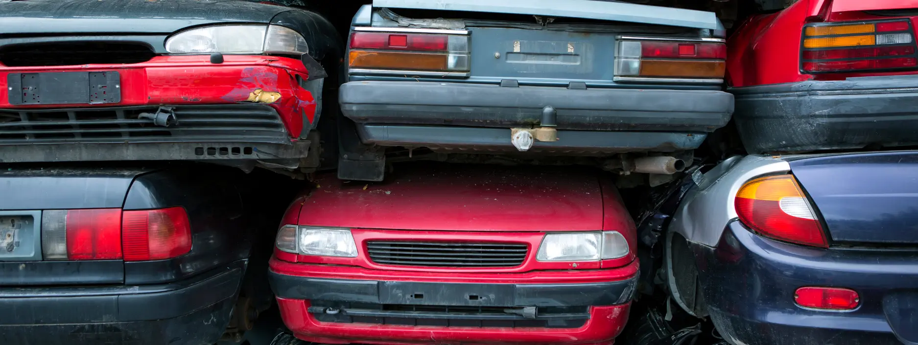
To help avoid an unnecessary breakdown, why read our guides, such as this one on how to maintain your car if it’s not being driven often. Alternatively, if your car is becoming a breakdown risk whenever it takes to the road, it could be time to consider getting rid of it? Find out more about scrapping your car.
Methodology:
In order to quantify the worst place to break down in the country we started off by creating a dataset of all the roads in Great Britain – and all the latitude / longitude points on these roads. This gave us over 6,266,012 road point locations across England, Wales and Scotland.
We then created a list of factors that make breaking down particularly bad, i.e.
- Amount of rainfall (with more rain being worse)
- The temperature (with colder temperatures being worse)
- Distance from a petrol station (with longer distances being worse)
- Distance from a taxi company (with longer distances being worse)
- Phone signal (with longer distance from antennae being worse)
- Amount of traffic on the road (with more traffic posing more danger and thus being worse)
We ranked all of our road points based on these factors, and then took an average of these ranks to find the most inconvenient places in Great Britain to have a car breakdown – with the worst being the coldest and wettest, with poor phone signal, far from towns and service stations and with dangerous traffic levels on the road.
Data Sources
- Phone masts in UK: Openstreetmap api
- Taxi companies in UK: Openstreetmap api
- Service stations in UK: Openstreetmap api
- Volumes of traffic by road: Department of Transport (https://data.gov.uk/dataset/208c0e7b-353f-4e2d-8b7a-1a7118467acc/gb-road-traffic-counts)
- Road nodes: Openstreetmap api
- Temperatures and rain: Met office weather station data (eg. https://www.metoffice.gov.uk/pub/data/weather/uk/climate/stationdata/aberporthdata.txt)